
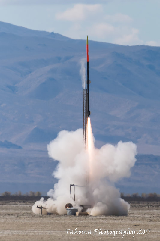
Noah Joraanstad has successful two-stage flight to over 96,000 feet!
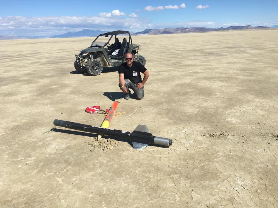
Noah Joraanstad flew the TelemetryPro tracking system to over 96,000 feet in his two-stage "Stratospheric Express" rocket at the BALLS-26 launch held at the Black Rock desert in Nevada on Sept. 23, 2017. It was an outstanding flight! It reached Mach 2.93. The flight was successfully tracked all the way up and down and then safely recovered 3.36 miles from the launch pad. This was an exceptionally vertical flight. Staging occurred at a tilt angle of only 1.02 degrees off vertical.
|
Rocket Name: "Stratospheric Express"
Booster motor: CTI N5800 Sustainer motor: CTI N3301 Length: 17 feet Weight: 105 lbs Max altitude: 96,092 feet (above ground level) Max velocity: 2.93 Mach Max acceleration: 14.0 G's Landing site: 3.36 miles from the launch pad Total flight time: 9 minutes, 51 seconds |
Press play to listen to Kate's commentary generated (in real time) during this flight. |
|
|
|
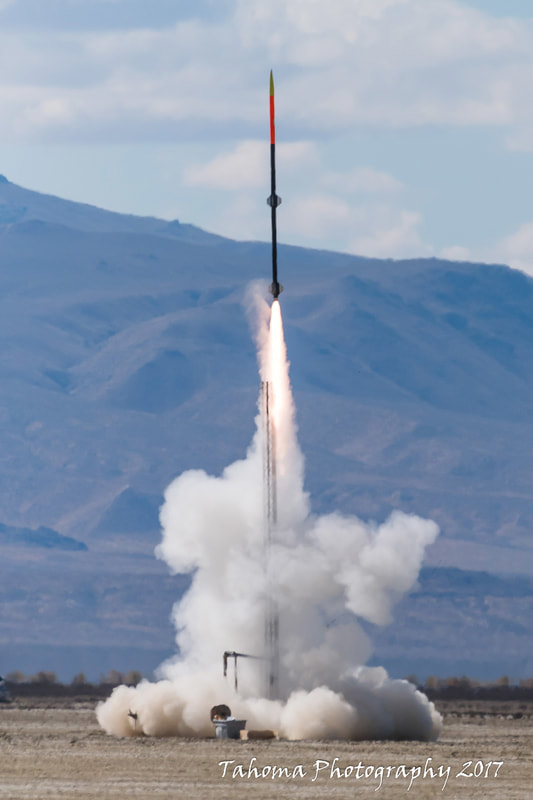
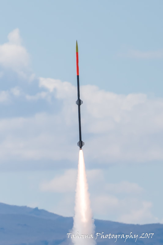
Launch photos courtesy Jim Wilkerson
|

|
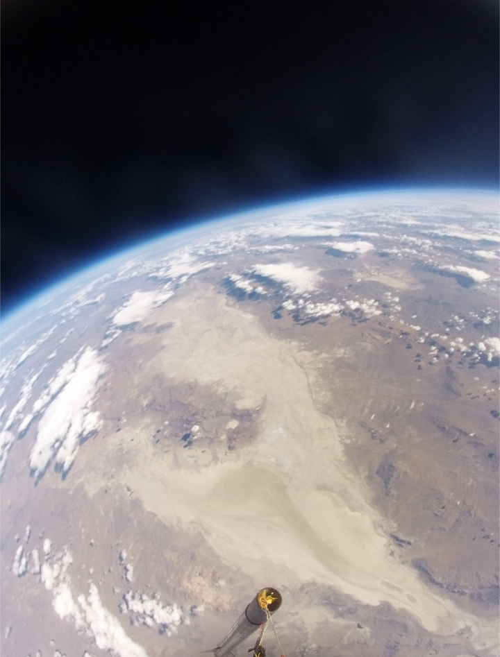
Flight photos and onboard video courtesy Noah Joraanstad
|
|
Onboard Flight Video Be sure to watch the onboard video! Noah created it by overlaying the Kate audio track onto the video recorded from his rocket during flight.
Some red paint on the exterior was smeared around the outside edges of the camera view port as it approached Mach 2.93. The camera view port is a sapphire window from Esco Optics. |
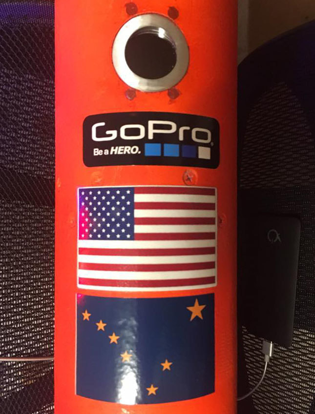
Camera view port preflight.
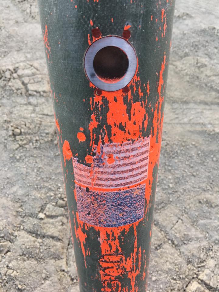
Camera view port post flight.
|
|
|
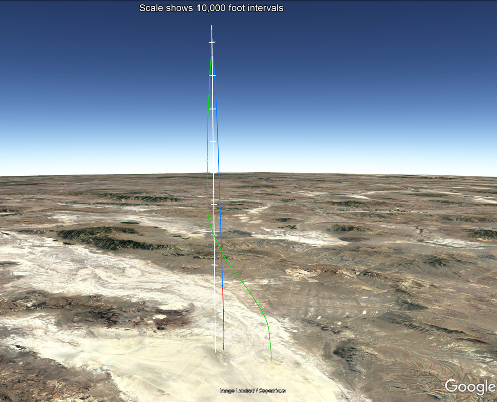
Google Earth
Flight Trajectory This image shows the flight trajectory recorded by TelemetryPro. Red indicates motor burn. Blue is coast. Green is descent on drogue parachute. This was an exceptionally vertical flight! Staging occurred at only 1.02 degrees of tilt. Even the descent was virtually straight down from 96,000 feet to about 40,000 feet. At 40,000 feet it hit the top of the jet stream and was pushed about three miles to the SSW.

Download
Download the Google Earth file to see a nice virtual 3D view of the entire flight from any angle.
Note: You will need to have Google Earth installed on your computer to view the file. |
|
|
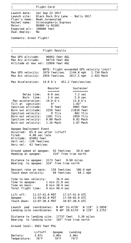
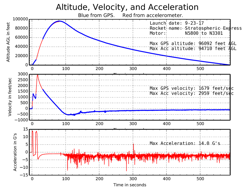
Flight Summary Report
The first two pages from the flight summary report are shown in these images. Click on them to get a closer look.
The complete flight summary report can be downloaded using the button below. 
Flight Summary Report
|
Note: This flight exceeded the maximum velocity limit for the GPS. (500 m/s or 1640 feet/sec.) Consequently, the GPS suspended the velocity readings and did not resume reporting velocities again until the actual velocity dropped back down below the limit. The TelemetryPro system has an accelerometer onboard and therefore can measure and report velocities higher than the GPS limit. The accelerometer reported the max velocity to be 2959 feet/sec.