
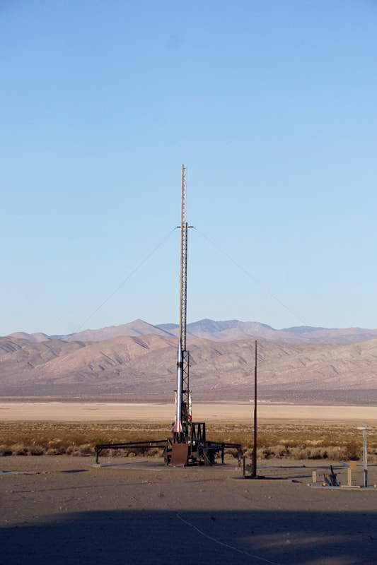
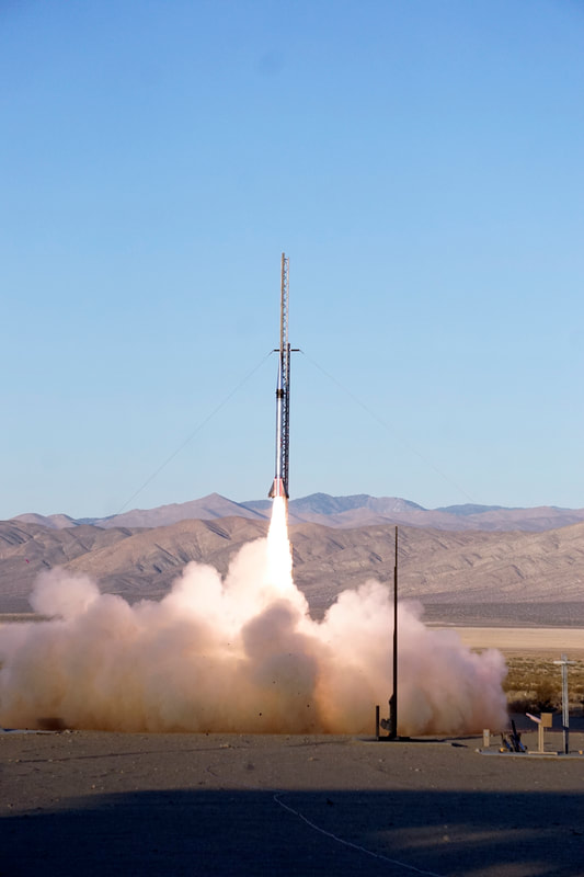
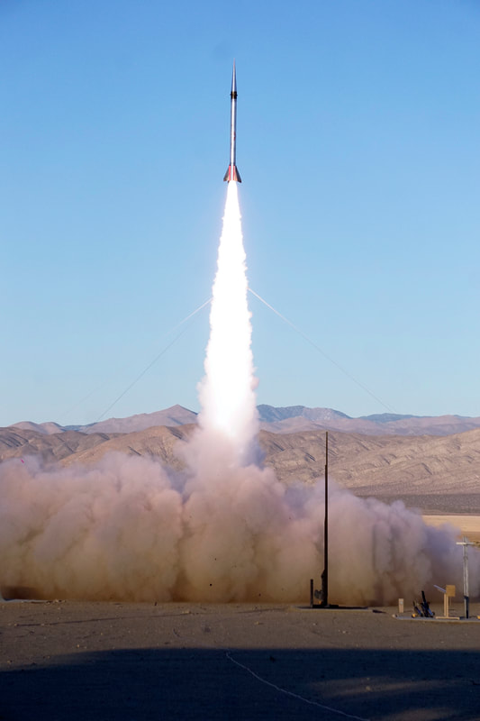
Evolution Space launches Kate-3 to over 188,000 feet!
Evolution Space launched the Kate-3 TelemetryPro tracking system to over 188,000 feet in a single stage test flight on Nov. 13, 2021. Two redundant Kate-3 systems controlled all flight operations including launch, de-spin, deployments, GPS tracking and telemetry downlink. Unfortunately, the flight suffered a mechanical failure in the nosecone release mechanism so no drogue parachute was deployed and the rocket impacted at high speed in a dry lake bed 3.2 miles away. However, in all other respects, it was a very successful test flight. The motor burn was spectacular, the yo-yo de-spin mechanism operated correctly and Kate-3 performed flawlessly. Another test flight is planned soon with an improved nosecone release mechanism and an even larger motor.
This test flight also demonstrated the unlimited altitude capability in the Kate-3 GPS tracking system. The maximum altitude was measured by the Kate-3 TelemetryPro GPS to be 188,444 feet. This is above the operating limit of other GPS tracking systems available to the hobby rocketry market. Furthermore, the Kate-3 system maintained a continuous telemetry downlink data stream during the entire flight. No data packets were lost even at over 188,000 feet.
This test flight also demonstrated the unlimited altitude capability in the Kate-3 GPS tracking system. The maximum altitude was measured by the Kate-3 TelemetryPro GPS to be 188,444 feet. This is above the operating limit of other GPS tracking systems available to the hobby rocketry market. Furthermore, the Kate-3 system maintained a continuous telemetry downlink data stream during the entire flight. No data packets were lost even at over 188,000 feet.
|
Mission Name: "Too Busy Chasing Stars"
Motor: S45000 Motor Size: 10" diameter x 10 feet long Rocket Size: 10" diameter x 18 feet long Weight: 720 lbs Max altitude: 188,444 feet (above ground level) Max velocity: 3.95 Mach Max acceleration: 20.3 G's Burn time: 9.8 sec Burnout altitude: 19,398 feet Time to apogee: 111.7 sec Time to impact: 228.2 sec |
Kate announced altitudes in real time during ascent based on GPS and accelerometer information. The climb to apogee was spectacular! However, due to a mechanical failure in the nosecone release mechanism, the rocket began accelerating back down toward the ground after apogee. Kate was able to call out information until about 141,000 feet which is when the descent velocity exceeded the GPS operational velocity limit. (1700 feet/sec.) The Kate commentary stopped at that point because there was no further GPS information available for the remainder of the flight. The rocket came in ballistic at over 1700 feet/sec until impact.
Press play to listen to Kate's commentary generated during this flight. |
|
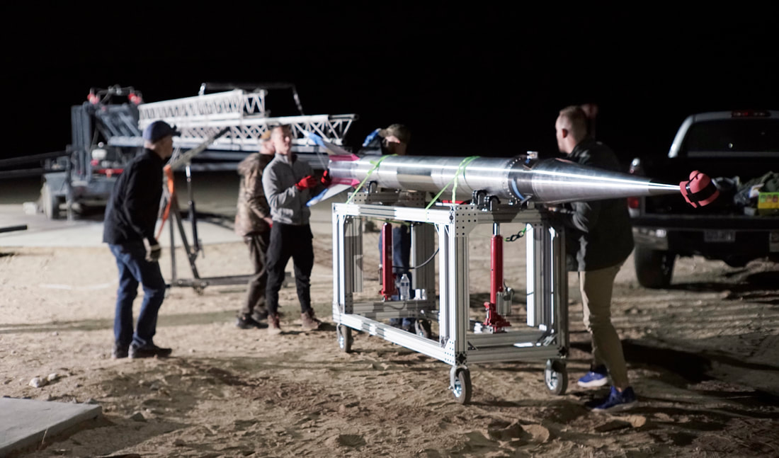
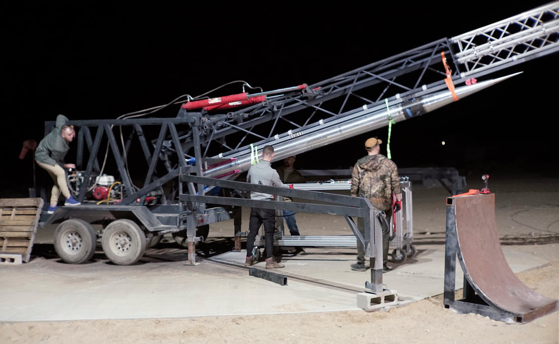
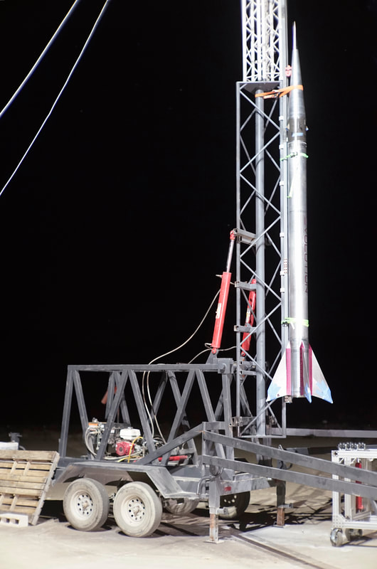
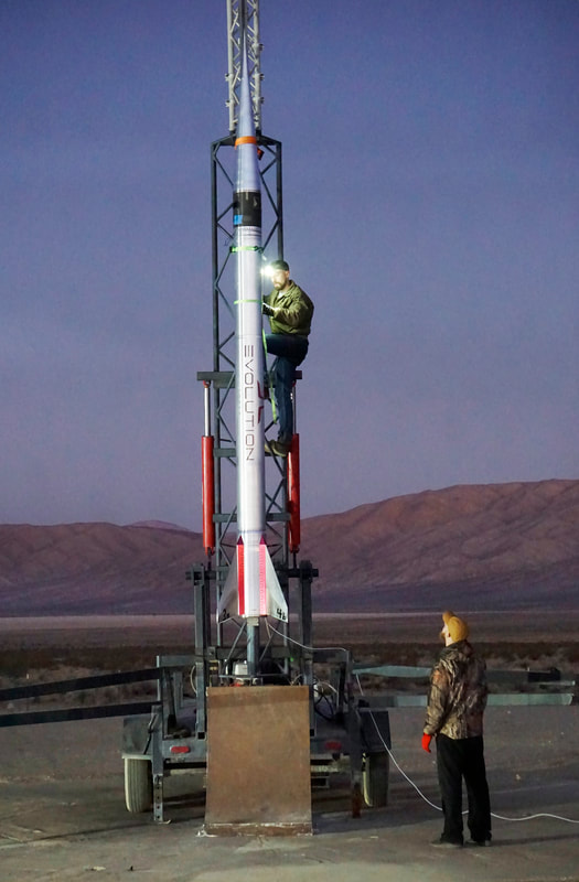
Launch Video Liftoff was scheduled for 6:45 am so this video starts by showing the team rolling out the rocket from the assembly building to the launch pad in the early morning hours before sun up. The audio track is from comments made by Steve Heller over the PA system just prior to launch. Steve is the CEO and founder of Evolution Space.
|
|
|
|
|
|
|
|
|
All photos above are by Peter Thoeny at Quality HDR Photography Copyright 2021.
More photos |
John Demar has kindly provided some additional photos and a short video. Thanks John!
|

Link to John's Google Photos page.
|
|
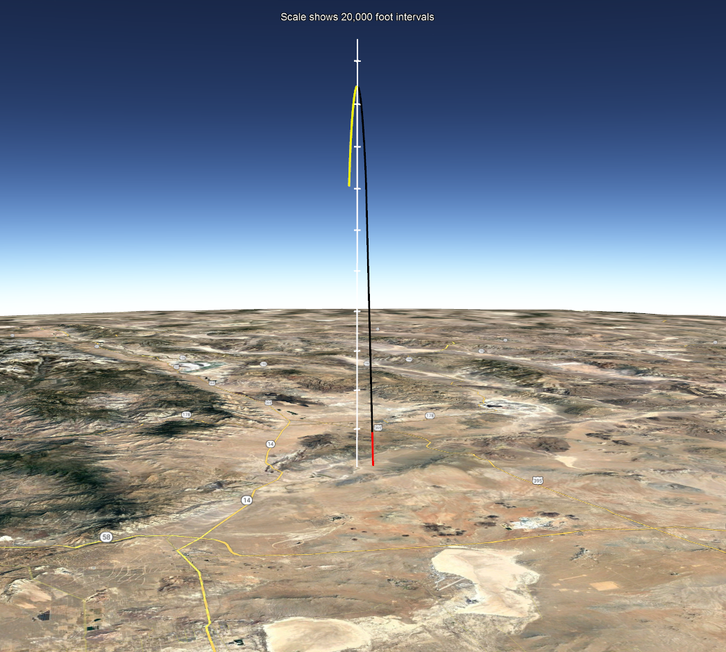
Flight Trajectory
This image shows the flight trajectory recorded by the Kate-3 GPS. It is a Google Earth view looking north at the launch site in the Mojave desert of California.
Red indicates motor burn. Black shows the coast phase. Yellow is the descent phase. The white line with tic marks is drawn from apogee straight down to the ground. The tic marks are 20K feet apart. During descent the GPS lockout velocity was reached while the rocket was still 141,000 feet high. That is the point where the yellow portion of the trajectory plot ends because no more GPS readings were available beyond that point. This trajectory was used to estimate the location of the impact. It was estimated to be about 3.2 miles west of the launch pad. Unfortunately, the actual impact site was never found. |
|
Download this Google Earth file to zoom in or view the flight trajectory from any angle. You will need to have Google Earth installed on your computer to view this file.
| ||