
40,000 feet and Mach 2.4 but unfortunately no deployment!
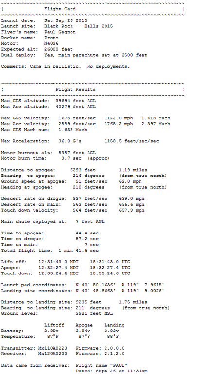
Paul Gagnon flew the TelemetryPro tracking system to 39,694 feet at the BALLS-24 launch held at the Black Rock desert in Nevada on Sept. 26, 2015. Unfortunately, the recovery system failed and there was no drogue parachute and no main parachute deployed. The rocket came in ballistic and impacted at 657 mph about 1.5 miles away.
|
Rocket Name: "Proto" Motor: N4036 98mm research motor Weight: 46 pounds Max altitude: 39,694 feet Max velocity: 2.4 Mach Max acceleration: 36.0 G's |
Kate's Flight Commentary
Press play to hear the flight commentary delivered by Kate in real time during this flight. This is a good example of what Kate says during a ballistic return. |
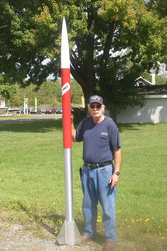
Photo courtesy Paul Gagnon
|
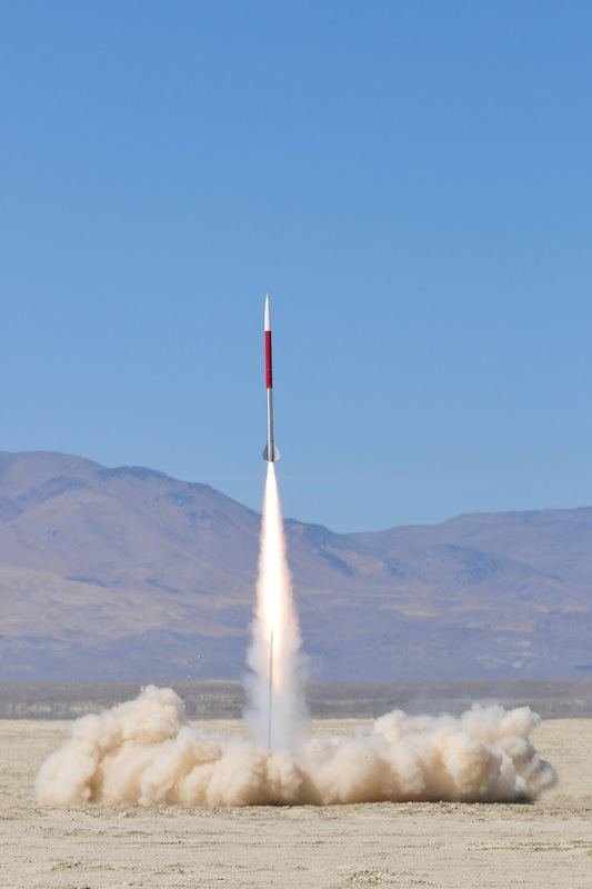
Photo courtesy ROCKETS magazine
|
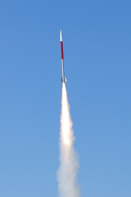
Photo courtesy ROCKETS magazine
|
The aluminum fin can was mounted directly to the 98 mm x 48" Tru-Core motor case. The upper air frame was 6061-T6 with an aluminum coupler combination E-bay that included two SL-100's and a video camera. The TelemetryPro transmitter was mounted in the fiberglass nosecone.
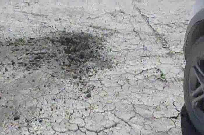
Photo courtesy Paul Gagnon
|
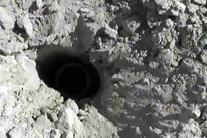
Photo courtesy Paul Gagnon
|
The TelemetryPro system guided Paul directly to the impact site. There was just a small hole. If you look close you can see the tail end of the rocket inside the hole and below the surface of the playa. |
Paul said he believes the deployment failure may have been caused by an excessive heat soak while it sat on the pad for over 1.5 hours in the sun. It may have expanded around a very precise fit aluminum nosecone collar and made it too tight for the deployment charge to expel the nosecone.
|
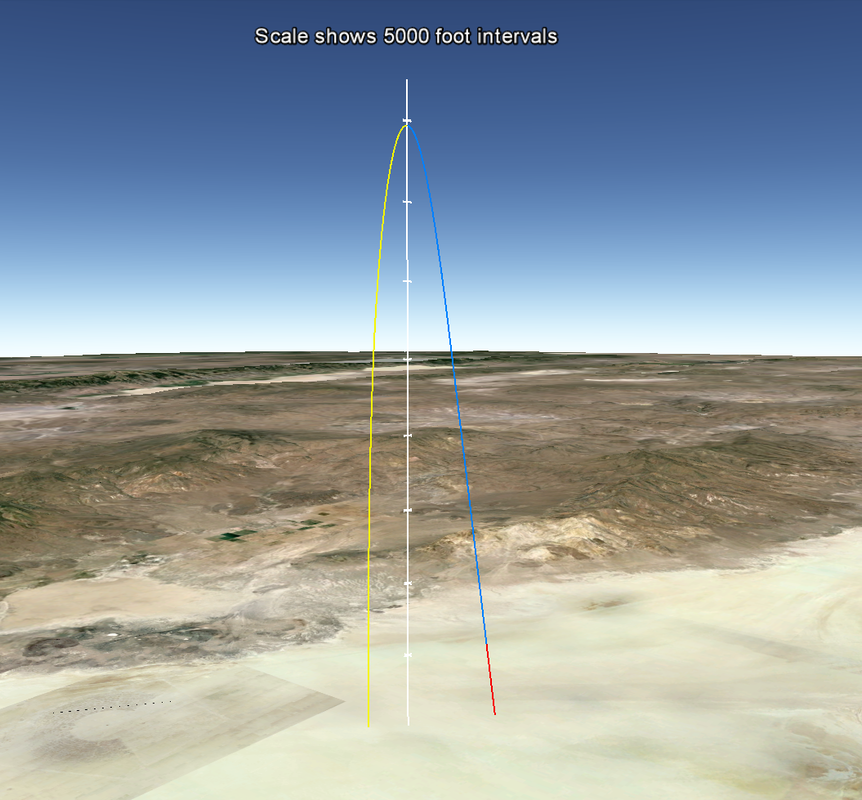
Google Earth
Flight Trajectory This image shows the flight trajectory recorded by TelemetryPro during the flight. The red section shows the duration of the motor burn. The blue section is the coast to apogee. Yellow is the ballistic return.

Download
Download the Google Earth file and you will be able to view the trajectory from any angle. It gives a nice virtual 3D view of the entire flight.
Note: You will need to have Google Earth installed on your computer to view the file. |
|
Excel spreadsheet for the flight
|
Flight Summary Report
The first two pages from the flight summary report are shown in these images. Click on them to get a closer look.
The full flight summary report can be downloaded using the button below. 
Flight Summary Report
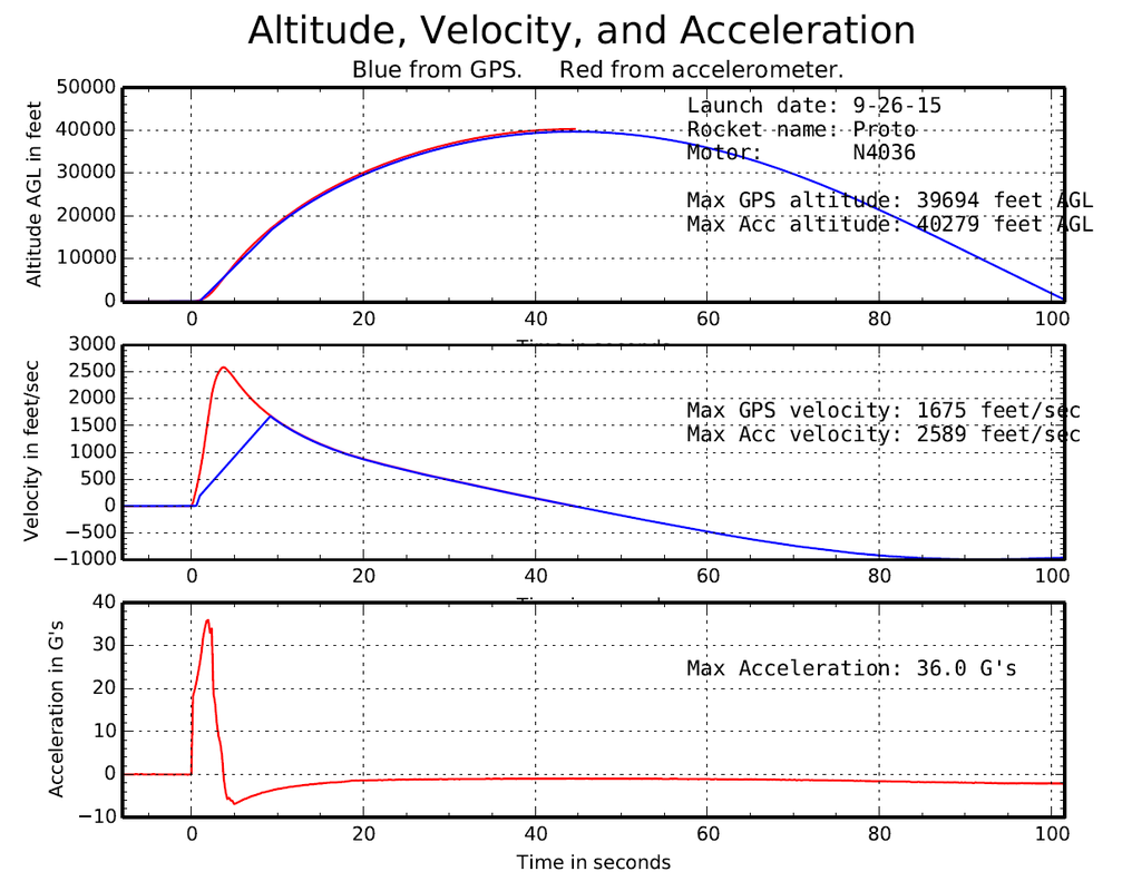
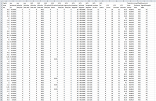
Excel Spreadsheet TelemetryPro automatically generates an Excel spreadsheet containing all of the raw data. Click on the spreadsheet shown here to open Excel and see the data from this flight.
|
Note: This flight exceeded the maximum velocity limit for the GPS. (500 m/s or 1640 feet/sec.) Consequently, the GPS did not resume reporting accurate velocities until the actual velocity dropped back down below the limit. The TelemetryPro system has an accelerometer onboard and therefore can measure and report velocities higher than the GPS limit. The accelerometer reported the max velocity to be 2589 feet/sec.